

Chiapas
Maya cities in the jungle, highlands and quiet lakes
Maya cities in the jungle, highlands and quiet lakes
Palenque (UNESCO World Heritage since 1987), Yaxchilán on the border river Usumacinta, around 59 lakes near Montebello and Tzotzil communities at 2,200 meters: Chiapas is the region of Mexico where jungle, Maya culture and the present are most closely intertwined — five days, with a driver, without crowding.

Best time to travel
November to April
Why Chiapas — cloud forest, Maya cities and vibrant culture
Just before seven o'clock, the mist still hangs between the pines over San Cristóbal de las Casas. The market smells of charcoal, coriander, and coffee from the Sierra, women from Chamula spread out black wool skirts, a bell rings. Two hours by car north, another Chiapas begins: howler monkeys over the temples of Palenque, water turning turquoise over limestone, a border river accessible only by boat.
Most Mexico travelers skip Chiapas — too far, too little beach. What they miss: Palenque, a UNESCO World Heritage since 1987, the Montes Azules Biosphere Reserve, a UNESCO Biosphere Reserve since 1979, around 59 lakes near Montebello and highland communities where Tzotzil and Tzeltal preserve their language and rituals. Whoever plans a Mexico tour gives the region five days — and gets places where they are alone by eight in the morning.
Sights in Chiapas — highlands, jungle and lakes
San Cristóbal de las Casas — Pueblo Mágico at 2,200 meters
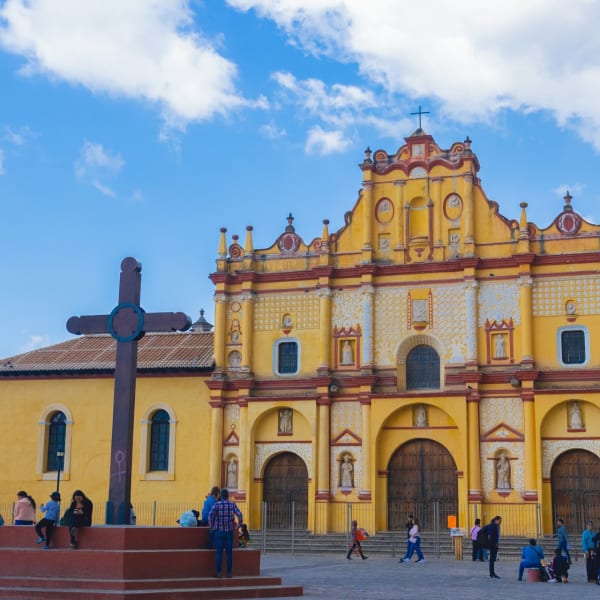
San Cristóbal, founded in 1528 and designated Pueblo Mágico since 2003, is located at about 2,200 meters in a high valley — cool, clear, cobbled streets, colonial churches, coffee culture. The Templo de Santo Domingo with its baroque plaster facade is the landmark; next door, the Centro de Textiles del Mundo Maya shows hundreds of outfits from Chiapas and Guatemala — the best introduction before you head into the villages. The Museum Na Bolom tells the story of the Lacandon (Tue–Sun, approx. 45 MXN), the Mercado Municipal is most vibrant in the morning, and in the evening, the Real de Guadalupe belongs to cafés and Mezcalerías.


Ten kilometers further lies San Juan Chamula — a Tzotzil community with its own administration and a church without benches: pine needles on the floor, hundreds of candles, families praying with healers in Tzotzil, along with Pox, the corn spirit. A place of worship, not a museum. Zinacantán at 2,558 meters is the counterpart: greenhouses full of cut flowers, flower-embroidered shawls, looms in backyards.
San Juan Chamula — visit respectfully
In the church, there is a strict prohibition on photography — also for mobile phones, also without flash; violations are punished by the community police up to confiscation of the camera. In the village, you photograph people only with explicit consent. Entrance is approx. 30 MXN at the tourism office at the plaza, market on Sundays. We strongly recommend a guide from the community — he explains the rituals, and you won't step on anyone's toes.
Palenque — UNESCO World Heritage since 1987
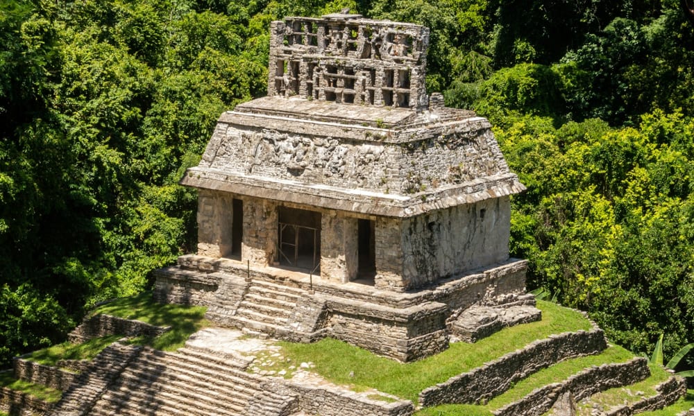
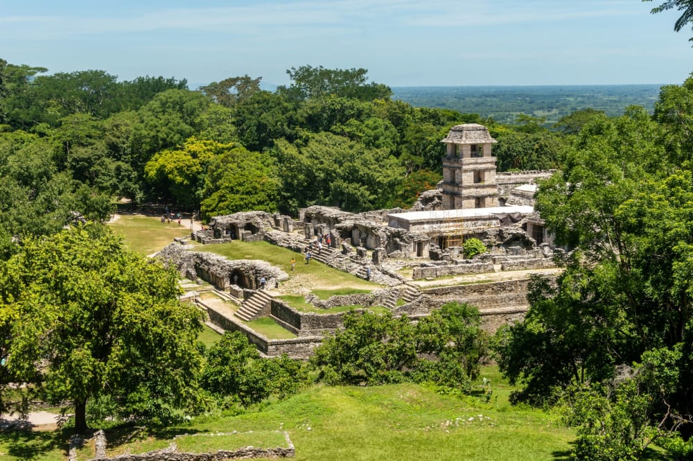
Palenque is the Maya city experienced in the jungle: temples on terraces between rainforest giants, mist in the treetops, howler monkeys as a wake-up call. Since 1987 a UNESCO World Heritage site — yet estimates from INAH suggest less than two percent of the former city has been uncovered. The palace with its four-story tower, the Temple of Inscriptions, under which Alberto Ruz Lhuillier discovered the tomb of King Pakal in 1952, the cross group: three hours with a good guide is enough for the essence. From 08:00 onwards, the places are empty, around 11 o'clock groups and heat arrive — therefore overnight in Palenque, not in Villahermosa.
Palenque
- Entrance — 210 MXN (approx. 11 EUR) INAH ticket, category I (rate 2026); plus the national park fee at the museum cash desk (lastly approx. 215 MXN / 11 EUR); shuttle to the entrance approx. 60 MXN
- Opening hours — Daily from 08:00; site museum Tue–Sun
- Location — 8 km west of the city of Palenque; Tren Maya station (Pakal Ná) 2 km north of the city
- Tip — Stand at the ticket office before 08:00, first head up to the cross group — the groups start at the palace
Yaxchilán and Bonampak — Maya cities on the border river
You can only reach Yaxchilán by boat: From Frontera Corozal, 160 kilometers southeast of Palenque, it takes about 40 minutes down the Usumacinta — Mexico on the right, Guatemala on the left, crocodiles on the sandbanks. Then the ruins emerge from the forest: 120 buildings, around 50 accessible, door lintels with reliefs of Queen Xook and the ruler Bird-Jaguar IV. No bus, no stalls — just boat, howler monkeys and you.
Bonampak, 21 kilometers away in Lacandona territory, adds color to Yaxchilán: The three rooms of the Temple of Paintings (dated 790, rediscovered in 1946) depict court ceremonies, a battle, and the prisoners afterward. In the last kilometers, you travel in a vehicle of the Lacandon community Lacanjá Chansayab — this is part of the concept.
Yaxchilán and Bonampak
- Entrance — Yaxchilán: INAH ticket approx. 150 MXN (8 EUR) plus boat approx. 1,500–2,000 MXN (75–100 EUR) per boat; Bonampak: ticket, community fee and Lacandon transport approx. 400–500 MXN (20–25 EUR)
- Opening hours — Both sites daily from 08:00; last boats in the early afternoon
- Location — Frontera Corozal 160 km / approx. 3 h from Palenque via federal highway 307; turnoff for Bonampak at San Javier
- Tip — Better with a night in the Lacandon camp in Lacanjá: Yaxchilán in the afternoon, Bonampak the next morning
Cascadas de Agua Azul and Misol-Ha — water over limestone
64 kilometers south of Palenque, the Río Agua Azul cascades over hundreds of limestone steps — dissolved carbonates color the water so turquoise that photos look edited. Misol-Ha, 20 kilometers before Palenque, is a single fall of around 35 meters into a dark basin; a path leads behind the curtain into a cave.
Honestly — Agua Azul in the rainy season
The turquoise exists from November to April. From May to October, the river carries so much water that the cascades are brown instead of turquoise and swimming is usually prohibited — more powerful, but not the image from the brochure. Those traveling in the rainy season should plan Misol-Ha and skip Agua Azul without remorse. Entrance is approximately 30–50 MXN (2–3 EUR) as a community contribution, cash only.
Lagos de Montebello — 59 lakes at the border with Guatemala
At 1,500 meters, where the highlands drop to the border, lie the Lagos de Montebello: about 59 lakes are counted by the park administration CONANP in the national park (since 1959, Ramsar wetland since 2003). Each lake has its own color — emerald, turquoise, cobalt, almost violet — depending on depth, minerals, and light. At the Pojoj, fishermen paddle you on balsawood rafts to the island, in Tziscao, community cabins stand by the shore.
Lagos de Montebello
- Entrance — approx. 36 MXN (2 EUR) national park; raft ride Cinco Lagos approx. 250 MXN (13 EUR); walking path Pojoj approx. 30 MXN
- Opening hours — During the day; colors are most intense between 10 and 14 o'clock
- Location — approx. 55 km southeast of Comitán (1 h), approx. 2.5–3 h from San Cristóbal; along the way, the waterfalls El Chiflón (approx. 80 MXN)
- Tip — With a night in Comitán or Tziscao — then you'll see the lakes in the morning light
Laguna Miramar and Las Nubes — community ecotourism in the Lacandon forest
The Laguna Miramar is located in the middle of the Montes Azules Biosphere Reserve: about 1,000 hectares of crystal clear water, limestone islands, forest to the horizon, no motorboat, no hotel. The reserve (331,200 hectares, since 1978) hosts about one fifth of Mexico's biodiversity on 0.16 percent of the land area, according to CONANP. The Ejido Emiliano Zapata manages access as a community project: guide, tent or hammock under a palapa by the lake, the money stays in the village. Las Nubes in the southeast, near Maravilla Tenejapa, is the more accessible brother: the Río Santo Domingo foams turquoise through a gorge, hanging bridges cross the cascades, the community rents simple cabins — about three hours of driving from Comitán.
Realistically approaching — Miramar and Las Nubes
The Laguna Miramar is an expedition, not a trip: from Ocosingo, it’s four to five hours on a dirt road to Ejido Emiliano Zapata, then about seven kilometers on foot or by canoe, overnight without electricity and signal — three days from San Cristóbal, with a driver who knows the route. Las Nubes is accessible by car, but is also only sensible with an overnight stay. Both are located in the border area with Guatemala — we plan them exclusively with the current assessment of our partners on-site.
Cañón del Sumidero — addition on the way from the airport
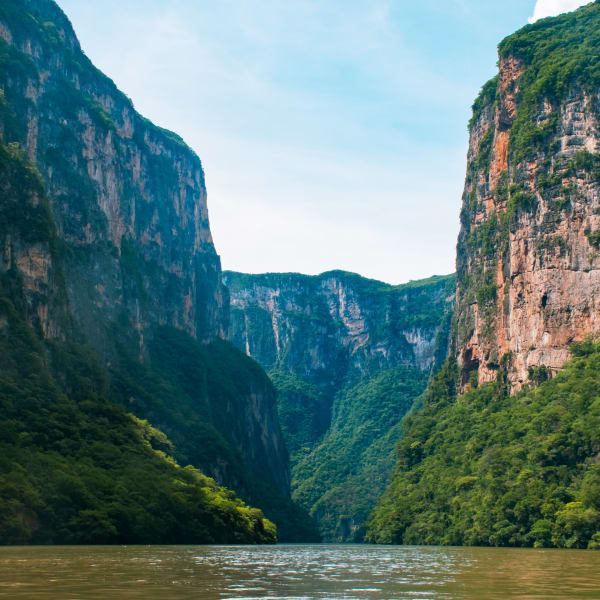
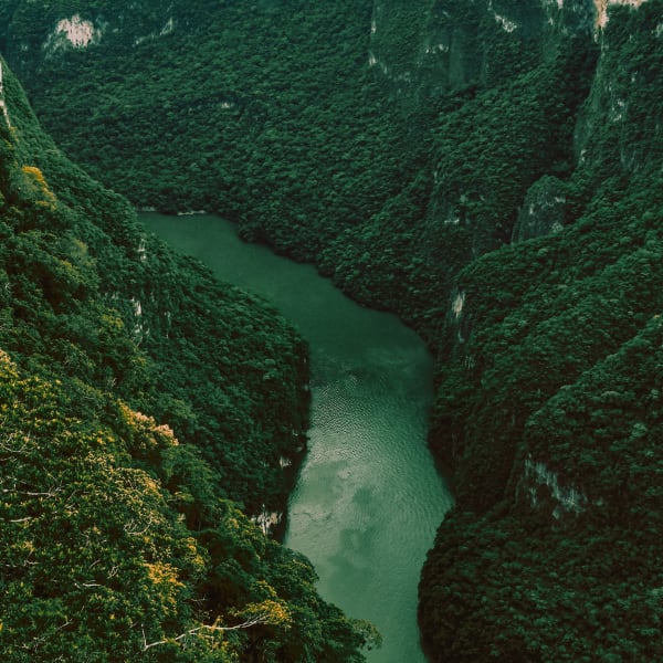
The Cañón del Sumidero is on the way from the airport to San Cristóbal: From Chiapa de Corzo, boats travel two hours through the gorge of the Río Grijalva, whose walls rise up to 1,000 meters — a national park since 1980, with crocodiles, spider monkeys, and the "Christmas tree," a moss-covered limestone curtain.
Cañón del Sumidero
- Entrance — Boat tour approx. 320–400 MXN (16–20 EUR) per person in the shared boat, plus national park fee
- Opening hours — Landing stages Chiapa de Corzo and Cahuaré approx. 09:00–16:30; boats depart when full
- Location — Chiapa de Corzo, 15 min from the TGZ airport, 1 h from San Cristóbal
- Tip — Plan directly from the airport on the day of arrival — the morning light is best
Culinary in Chiapas — coffee, Pox and tamales from the highlands
Chiapas is, according to the Ministry of Agriculture SADER (harvest year 2024), the largest coffee producer in Mexico — the cooperatives of the Sierra deliver Arabica, which you drink freshly roasted in the cafés of San Cristóbal; small fincas offer tours with tastings (approx. 300–600 MXN). Also Pox, the corn spirit of the Tzotzil — formerly ritual, today mixed in the bars of the Real de Guadalupe with coffee or hibiscus. Eat tamales de chipilín, sopa de pan (bread soup with saffron, a legacy of the monasteries), cochito horneado and cheese from Ocosingo; in Chiapa de Corzo, a pozol is included, a cold cocoa-corn drink.
Your Chiapas program — five days
Five days make a route without retracing steps: two nights in the highlands, through the mountain road into the jungle, two nights in Palenque, continue by Tren Maya or flight.
Day 1 — Arrival in TGZ, Cañón del Sumidero, San Cristóbal
Morning flight from Mexico City, your driver waits in TGZ. Boat tour through the Sumidero, lunch in Chiapa de Corzo, then in the afternoon up to San Cristóbal. Early to bed — you feel the altitude.

Day 2 — San Juan Chamula, Zinacantán and the city
In the morning with a guide from the community to Chamula and Zinacantán, lunch with tortillas from the comal in a family house, in the afternoon Centro de Textiles and market.
Day 3 — Mountain route to Palenque with Toniná, Agua Azul and Misol-Ha
Departure at 07:00 with a driver. First stop Toniná near Ocosingo (155 MXN), whose acropolis is, according to INAH (2015), about 75 meters higher than the Sun Pyramid of Teotihuacán — and almost empty. Lunch at Agua Azul, afternoon at Misol-Ha, arrival in Palenque before dark.
Day 4 — Yaxchilán and Bonampak on the Usumacinta
Departure at 06:00 via federal highway 307, boat from Frontera Corozal, Yaxchilán in the late morning, Bonampak in the afternoon, back around 19 o'clock — or you stay in Lacanjá and share the day.
Day 5 — Palenque at eight, then continue
At 08:00 at the ticket office, three hours of ruins with a guide. Lunch Tren Maya towards Campeche and Mérida or transfer to Villahermosa for the flight. If you have seven days, add Comitán and Montebello between days 2 and 3.
Where to stay in Chiapas — colonial houses, jungle lodges, community camps
For Chiapas, we currently do not have a house in our hotel portfolio — the right accommodation depends on your route. Three categories we know and recommend:
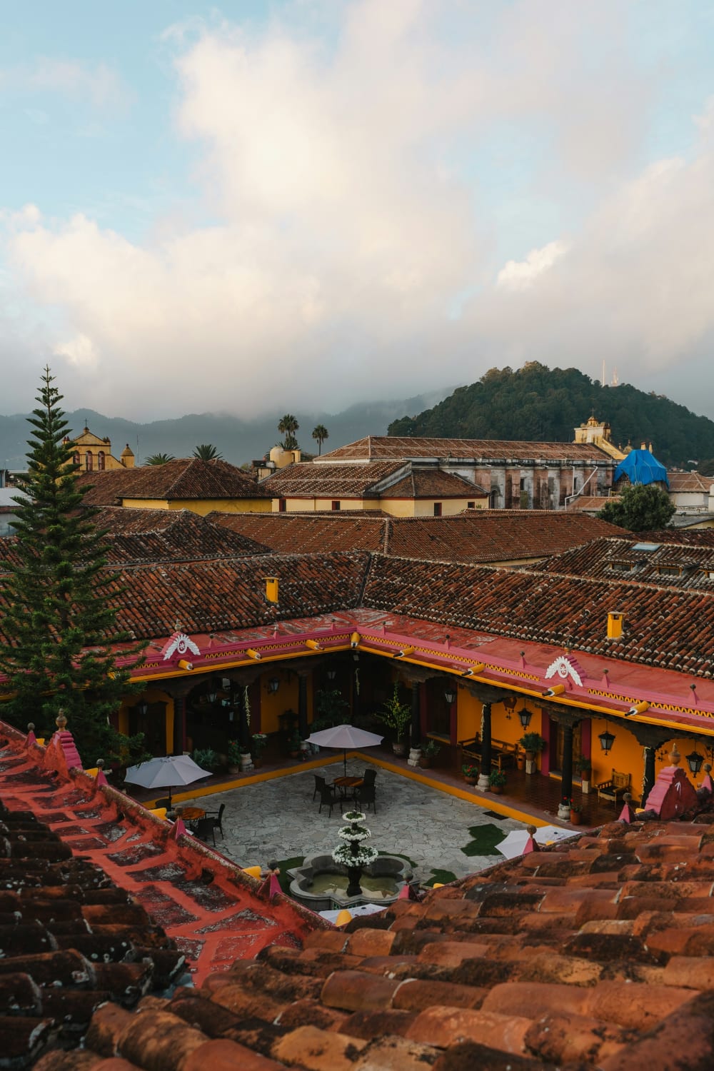
Boutique hotels in San Cristóbal — colonial houses with courtyard, fireplace in the room (it gets cold at night) and coffee from the region for breakfast. Approx. 120–280 EUR per night.
Jungle lodges near Palenque — bungalows in the woods on the road to the ruins, pool, howler monkeys at dawn; ideal for entry at eight. Approx. 100–250 EUR per night.
Community cabins and camps — Lacandon camps in Lacanjá, cabins in Tziscao and Las Nubes, hammock at Laguna Miramar: simple, clean, unforgettable. Approx. 20–60 EUR per night, paid in cash.
Let's put together the accommodations for your route — we know which colonial house has a quiet courtyard. Arrange a consultation .
Good to know
Best time to travel to Chiapas
November to April is the dry season — turquoise water in Agua Azul and Montebello, 20 to 25 degrees in the highlands, 28 to 33 degrees in Palenque; December and January bring nights around 4 degrees in San Cristóbal. From May to October, over 1,100 millimeters of rain fall, mostly in the afternoon: jungle at its greenest, cascades brown, the road to Laguna Miramar often impassable. More in the guide to the best travel time for Mexico .
Getting there — Tuxtla Gutiérrez Airport (TGZ)
Ángel Albino Corzo Airport (TGZ) near Chiapa de Corzo is the gateway to the highlands: Aeroméxico, Volaris, and Viva fly several times a day from Mexico City (about 1 hour 45), plus connections from Monterrey and GDL. It takes 75 minutes to San Cristóbal (taxi approx. 600 MXN). For the jungle, Villahermosa (VSA, 2 h to Palenque) is the alternative; Tren Maya connects Palenque with Campeche, Mérida, and Cancún. Details in our guides Flight to Mexico and Entry and visa .
Safety in Chiapas
Chiapas is a quiet, rural state where travelers have been welcomed for decades — San Cristóbal, the highland villages, Palenque, and the corridor to Usumacinta are visited daily; the center of San Cristóbal is also lively in the evening. The Foreign Office explicitly mentions federal highway 307 from Palenque to Bonampak, Lacanjá and Frontera Corozal/Yaxchilán as passable, but advises against the rest of the border area to Guatemala (as of September 2026) — we therefore plan Montebello, Las Nubes and Laguna Miramar only with the current assessment of our partners and with a driver.
Four rules: overland journeys only during the day and with a driver; registered taxis or hotel-ordered cars in cities; respect local rules in indigenous communities and plan for time buffers for roadblocks from village communities; valuables in the hotel safe. The assessment from the Foreign Office and our rules for the entire country in the guide Safety in Mexico .
Mountain road Palenque–San Cristóbal
The 213 kilometers of federal highway 199 over Ocosingo are the most beautiful route in the region — pine forests, mist, milpa fields, then tropical forest — and full day with stops. We only drive it in daylight with a driver who knows the area and villages: Departure at 07:00, arrival before 18:00. ADO buses take the detour via Villahermosa (8–9 hours); a rental car is not recommended by us here.
Getting around — driver instead of rental car
Chiapas is the region where we most clearly recommend a private driver: long distances, winding roads, unlit speed hills, the most beautiful places away from any bus line. A driver with a car costs from approx. 3,500–4,500 MXN (180–230 EUR) per day; we organize Yaxchilán and Bonampak with boat and community transport from one source.
Altitude and climate change
Within a day, you switch from 2,200 meters and 8 degrees to 60 meters and 32 degrees in Palenque: warm layer for San Cristóbal, light long clothing and mosquito protection for the jungle, headlamp for the camps. There are no mandatory vaccinations; dengue protection belongs in every bag during the rainy season. More in our guides Vaccinations and health and Packing list Mexico .
Continue to discover Mexico
Chiapas is located at the southern end of the classic Mexico route — connected by Tren Maya or a short flight to the peninsula and Oaxaca:
- Yucatán — Chichén Itzá, Mérida, and cenotes; via Tren Maya from Palenque
- Riviera Maya & Caribbean Coast — Tulum, Bacalar, and Holbox as a conclusion after the jungle
- Oaxaca — Mezcal, Monte Albán, and Pacific Coast, flight from Tuxtla Gutiérrez
- Mexico City — the start of every journey, 1 hour 45 to TGZ
You can find all regions on the page for Mexico round trip . Let’s put together your Chiapas program — with a driver, guides from the communities, and accommodations that suit the route. Schedule a consultation .
To book a trip or for more information, contact us. We'll help you plan and guide you through your upcoming adventure!
Frequently Asked Questions
Yes, on the common routes: San Cristóbal, the highland villages, Palenque, and the corridor along Federal Highway 307 to Bonampak and Yaxchilán are visited daily, and the Foreign Office explicitly states that this stretch is passable (as of September 2026). It advises against the remaining border area to Guatemala — we only plan Montebello, Las Nubes, and Laguna Miramar with the current assessment of our partners. The most important rule: Overland trips only during the day and with a driver, registered taxis in the cities, respect local rules in the communities.
Five days is the sensible minimum: two nights in San Cristóbal for the city, Chamula, Zinacantán, and the Cañón del Sumidero, one day for the mountain road with Toniná, Agua Azul, and Misol-Ha, two nights in Palenque for Yaxchilán, Bonampak, and the ruins by eight in the morning. With seven days, Comitán and the Lagos de Montebello are added, with nine to ten days an expedition to Laguna Miramar or to Las Nubes. Less than four days does not justify the long journey.
The INAH ticket costs 210 MXN (approximately 11 EUR) for foreign guests — Palenque is category I of the rates valid in 2026; Mexicans and residents pay 105 MXN, free on Sundays. Additionally, there is the national park fee, which is collected separately at the museum ticket office, 1.3 km before the entrance (last assessed at approximately 215 MXN); the shuttle from the museum to the entrance costs around 60 MXN round trip. A licensed guide for three hours is approximately 1,200–1,800 MXN per group. Open daily from 08:00 — come at opening time.
November to April: dry season, turquoise water in Agua Azul and Montebello, 20 to 25 degrees in San Cristóbal and 28 to 33 degrees in Palenque. December and January are the coldest months in the highlands with nights around 4 degrees — a room with a fireplace is worth it. From May to October, more than 1,100 millimeters of rain fall, Agua Azul then turns brown and swimming is mostly prohibited, the path to Laguna Miramar is often impassable; however, the jungle around Palenque is the greenest and the sites are emptier.
By driver via Federal Highway 199 through Ocosingo: 213 kilometers, with stops in Toniná, Agua Azul, and Misol-Ha a full day — departure at 07:00, arrival before dark. We take this route exclusively during the day and with a driver who knows it. The ADO buses take the detour via Villahermosa and take 8 to 9 hours. Conversely, from Palenque, the journey ends via Tren Maya in Campeche or Mérida, or you fly from Villahermosa (2 hours transfer).
Not in the church — the ban is absolute, applies to phones as well, and is enforced by the community police, up to the confiscation of the camera. In the village and at the market, you can only photograph people with explicit consent, ceremonies and officials not at all. The entrance to the church costs about 30 MXN at the tourism office at the plaza, colectivos from San Cristóbal are about 22 MXN. The most respectful and rewarding visit is with a guide from the community, who explains the rituals with candles, pine needles, and Pox.
Yes — if you accept the long day: departure at 06:00, 160 kilometers via Federal Highway 307 to Frontera Corozal, 40 minutes by boat on the Usumacinta to Yaxchilán, in the afternoon Bonampak with the transport from the Lacandons, return around 19:00. Expect approximately 2,500–3,500 MXN per person including boat, entrance fees, and community fees. The nicer option is the variant with one night in a Lacandon camp in Lacanjá Chansayab: Yaxchilán in the afternoon without groups, Bonampak the next morning, in between the jungle at night.
No. The turquoise color comes from dissolved carbonates in the water and is only visible at low water levels, from November to April. In the rainy season from May to October, the Río Agua Azul carries so much water that the cascades are brown and swimming is mostly prohibited — the falls are then more powerful, but not the familiar image. Misol-Ha with its 35-meter fall is worth seeing all year round. Entrance at both places is approximately 30–50 MXN as a community contribution, cash only.